Day Trips
9 Best Day Hikes Near Tbilisi: Trails for Every Skill Level
Discover the 9 best day hikes near Tbilisi for all skill levels - from easy urban trails at Turtle Lake to challenging treks at Birtvisi Canyon. Trail tips and transport info included.


Georgia's capital sits in a valley surrounded by rolling hills and forested ridges, making it one of the best cities in the Caucasus for day hiking.
Within an hour of Tbilisi, you can climb to medieval monasteries, scramble through volcanic canyons, or stroll beside scenic lakes - no overnight gear required.
The trails range from paved urban paths to rugged backcountry routes, with options for families, casual walkers, and serious trekkers alike.
Quick Summary:
Turtle Lake to Mtatsminda offers panoramic city views on a beginner-friendly 6.5 km trail
Birtvisi Canyon features dramatic volcanic rock formations just 60 km from the city
Tbilisi National Park's Saguramo Ridge provides 11 km of forest hiking
The Kojori to Kiketi route passes a medieval fortress and waterfalls
All hikes are accessible by public bus, taxi via Bolt, or private transfer
Easy Tbilisi Hikes
1. Lisi Lake Loop
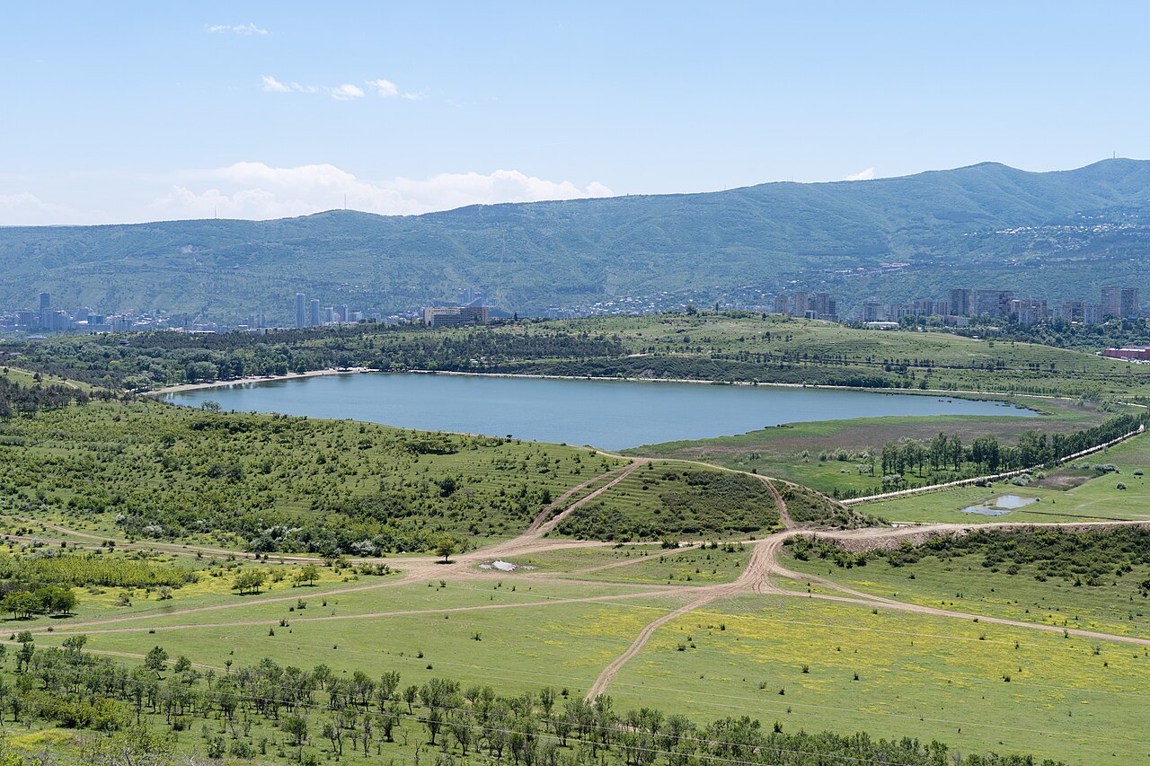
For a relaxed urban hike with minimal planning, Lisi Lake delivers. This popular recreation spot in northwest Tbilisi features a paved walking and cycling path around the water, plus options to extend into the surrounding hills.
The lake sits at about 700 meters elevation, where temperatures run cooler than the city center. Locals flock here for jogging, picnics, and cycling - bike rentals are available for around 10 GEL per hour. The shoreline has cafes, a beach area, and even a sulphur bath nearby.
For something more substantial than the flat loop, consider the Didgori to Lisi Lake trail. This longer route starts from Didgori village and crosses dry forest, grassland, and Lisi Ridge before finishing at the lake. Expect panoramic views over the Dighomi and Saburtalo districts.
Distance: 3-4 km (lake loop) or 15 km (Didgori to Lisi)
Duration: 1 hour (loop) or 5-6 hours (Didgori route)
Difficulty: Easy (loop) to moderate (Didgori route)
Best season: Year-round for lake loop; spring and autumn for Didgori trail
Getting there: Taxi via Bolt to Lisi Lake (10-15 GEL from center). For Didgori trail, taxi to Didgori village (20-25 GEL)
2. Botanical Garden to Narikala Fortress
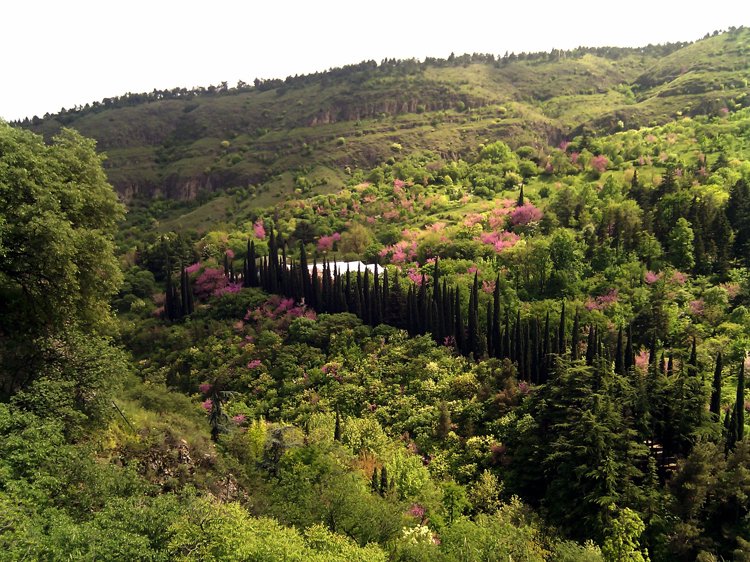
This short but satisfying urban trail connects two of Tbilisi's most iconic landmarks while delivering surprisingly wild scenery for a city-center hike. The National Botanical Garden sits in a valley behind Narikala Fortress, and multiple paths wind uphill through its 400 acres.
Enter through the main gate near the fortress or via steps near the Mother of Georgia statue. The lower paths meander through flower gardens and past a photogenic waterfall crossed by a white bridge. Higher up, the trails become more challenging and offer views back to the fortress walls and across the Old Town rooftops.
The entire Botanical Garden loop covers about 5 km with 170 meters of elevation gain. You can extend the walk by continuing to Narikala Fortress itself and the Kartlis Deda (Mother of Georgia) statue along the ridge. Entry to the garden costs 4 GEL.
Note: Narikala Fortress is currently closed for renovations until late 2025, though you can still visit the Mother of Georgia statue and the Botanical Garden.
Distance: 5 km (garden loop)
Duration: 1.5-2 hours
Difficulty: Easy
Best season: April to June (cherry blossoms in Japanese Garden); year-round
Getting there: Walk from Old Town or take the cable car from Rike Park (2.5 GEL one way)
3. Kojori to Tbilisi
One of the easiest short hikes accessible entirely by public transport, this trail starts from Kojori Fortress on the western outskirts and carries you downhill back into the city. On clear days, you can spot the Greater Caucasus peaks from the upper sections.
The route begins at Azeula Fortress (also called Kojori Fortress), an 11th-century ruin perched on a volcanic outcrop at 1,350 meters. After exploring the fortress via its metal staircase, walk through Kojori town - keep an eye out for impressive Soviet-era mosaics on the walls near the main square.
From Kojori, the trail continues to Udzo Monastery, a small active monastery with 360-degree views over Tbilisi. The path then descends through forest and emerges near Mtatsminda or Vera, depending on which fork you take.
Distance: 8-10 km depending on endpoint
Duration: 4-4.5 hours
Difficulty: Easy (mostly downhill)
Best season: Year-round (expect snow patches in winter)
Getting there: Bus 380 from Freedom Square to Kojori (1 GEL, 40 mins) or taxi via Bolt (25-30 GEL)
Moderate Tbilisi Hikes
4. Turtle Lake to Mtatsminda Park

This is the most popular hike in Tbilisi proper and the perfect introduction to the city's elevated terrain. The trail connects Turtle Lake (Kus Tba in Georgian) with Mtatsminda Park via a forested ridge that delivers sweeping views over the capital.
Starting from Sololaki, the first 2 km involve an uphill climb through urban forest to the TV Tower. From there, the path follows the ridge through shady woodlands before descending to Turtle Lake. The route is well-marked and suitable for families, though some sections have loose gravel.
Most hikers prefer starting from Sololaki and finishing at Turtle Lake - the 370-meter elevation gain feels easier in this direction, and reaching the lake at the end provides a satisfying reward. Once at Turtle Lake, you can rent paddle boats, swim in summer, or grab a coffee at one of the lakeside cafes.
Distance: 6.5 km one way
Duration: 2.5-3 hours
Difficulty: Moderate
Best season: April to June, September to November
Getting there: Walk from Rustaveli Metro or take the funicular to Mtatsminda Park
5. Kojori to Kiketi
This scenic forested route between two hillside villages offers a different flavour than the Kojori-to-Tbilisi trail. Instead of descending to the city, you head south through dense woodland toward waterfalls and the medieval Kabeni Monastery.
The trail is well-marked with yellow and white blazes and directional signposts at major junctions. The terrain stays mostly flat or gently rolling, with just one steep 2 km section after the Kiketi/Asureti junction. A river crossing about halfway through can be tricky during rainy season - you may need to remove your shoes.
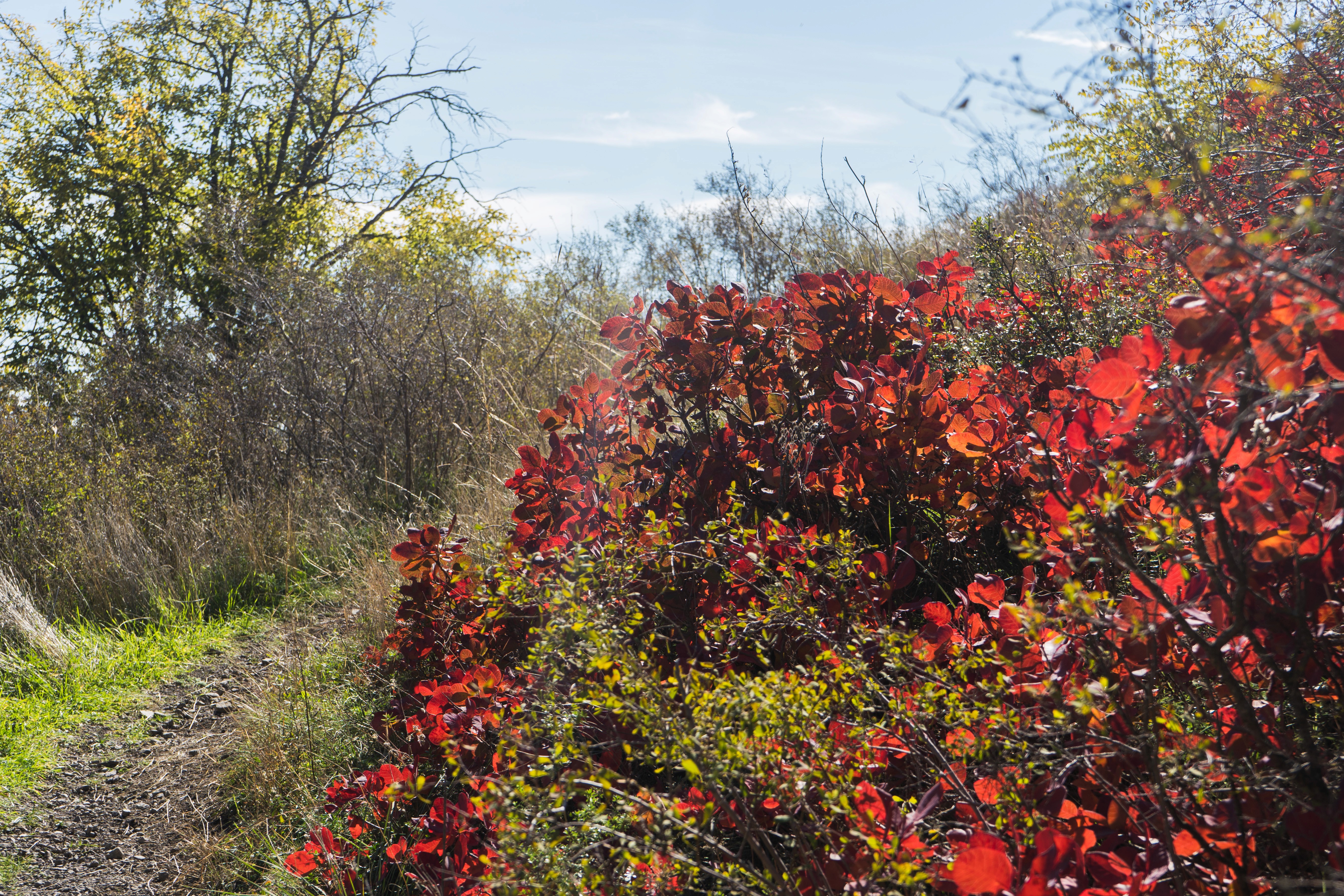
The route passes through some of the prettiest forest hiking near Tbilisi, with wildflowers in spring and colorful foliage in autumn. Either direction works, but starting from Kojori means slightly more downhill overall.
Distance: 7 km one way
Duration: 2-3 hours
Difficulty: Moderate
Best season: Mid-April to late June, September to November
Getting there: Bus 316 from Baratashvili Street to Kojori or Kiketi (1 GEL, 30-45 mins)
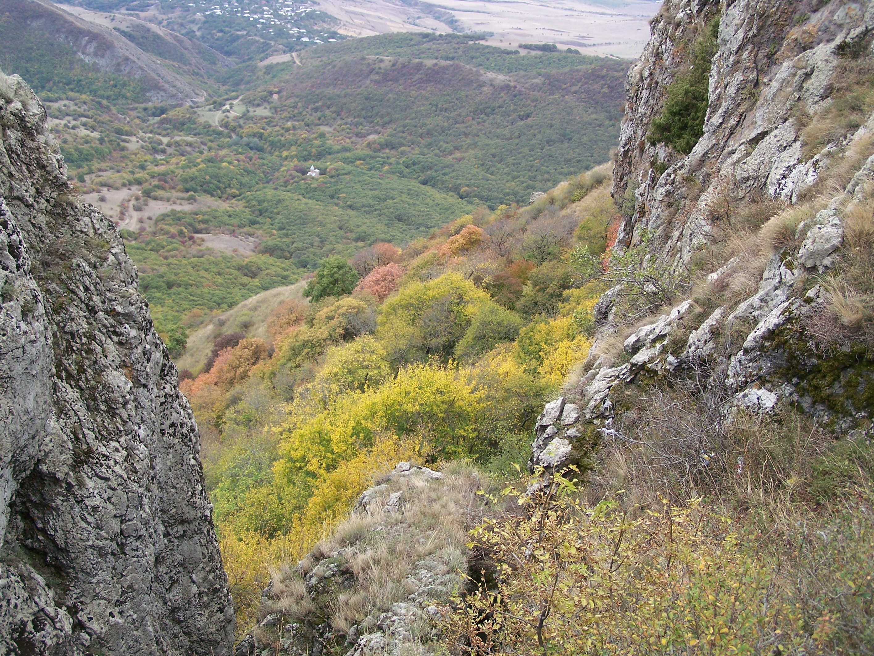
6. Samshvilde Canyon
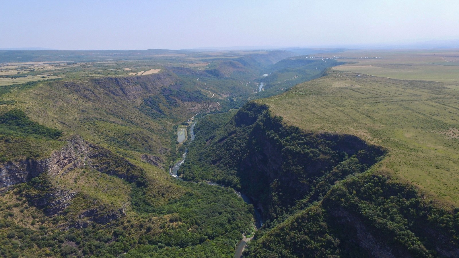
Samshvilde is often called the best hiking destination close to Tbilisi that most visitors never hear about. Located just 60 km south of the capital, this canyon follows the Khrami River past the atmospheric ruins of an ancient fortified town.
The trail was properly marked only in 2021, so it remains relatively undiscovered. You have two options: a short 4-5 km walk exploring the Samshvilde ruins, or the full 16 km loop around the canyon. The longer route follows the ridge and forest before descending to the river, then climbing sharply back to the historical site at the end.
Samshvilde works well in cooler months - spring, autumn, and even winter - when the weather is pleasant and the trail is accessible. Summer temperatures can be brutal, making July and August less ideal.
Distance: 4-16 km depending on route
Duration: 2-6 hours
Difficulty: Moderate
Best season: March to June, September to December
Getting there: 70 minutes by car from Tbilisi. Book a transfer via GoTrip or hire a taxi. Public bus available to Samshvilde village but service is limited
7. Saguramo Ridge Trail
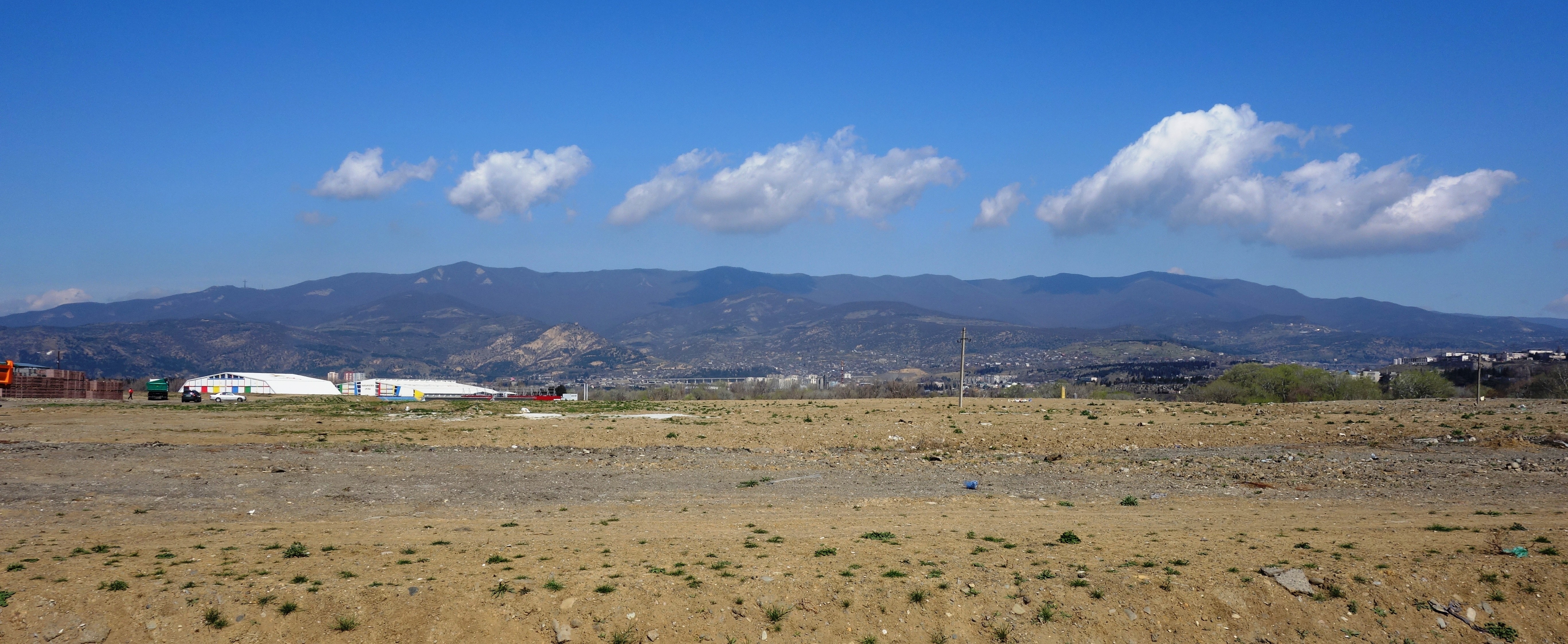
The flagship route of Tbilisi National Park winds along the Saguramo Ridge through a mix of forested areas and open paths. This is the sweet spot for intermediate hikers - challenging enough to feel like a proper trek, but manageable as a day trip from the capital.
The trail offers panoramic views over the Mtkvari and Aragvi river valleys, with the snow-capped Greater Caucasus visible on clear days. Along the way, you pass through diverse vegetation zones and can spot wildlife including deer and various bird species.
The Saguramo section alone makes for a satisfying half-day outing. For something more demanding, continue to Zedazeni Monastery, a 7th-8th century religious site at 1,250 meters elevation. The extended route to the monastery adds considerable distance and difficulty.
Distance: 11 km round trip (ridge trail only)
Duration: 4-5 hours
Difficulty: Moderate
Best season: April to November
Getting there: 45-minute drive from city center. No direct public transport - taxi or rideshare (30-40 GEL one way)
Challenging Tbilisi Hikes
8. Birtvisi Canyon
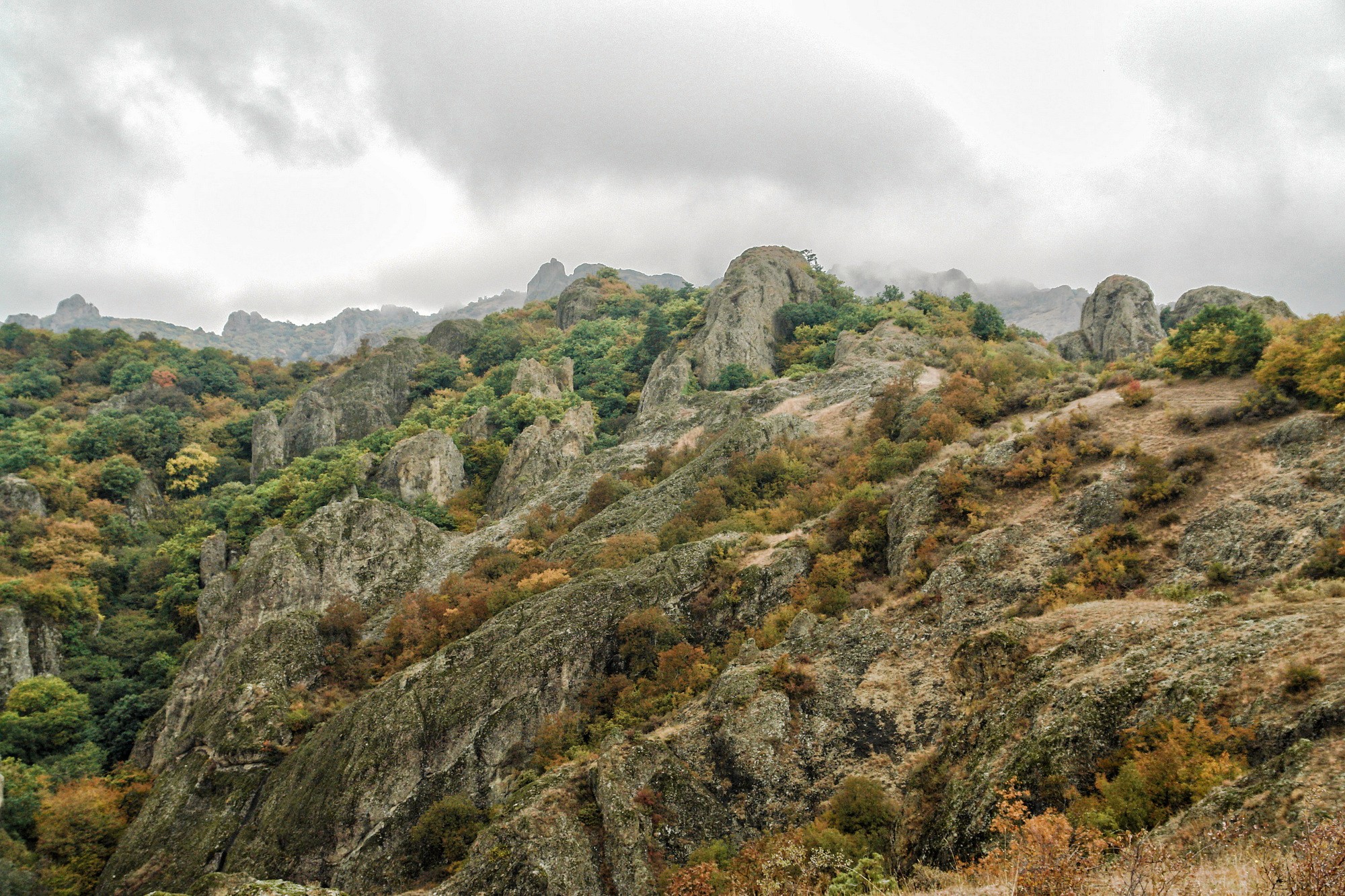
Birtvisi Canyon is where Tbilisi's hiking scene gets properly adventurous. This less-explored gorge features dramatic limestone formations that resemble a Cappadocian landscape, with cone-shaped rocks jutting from oak forest and a medieval fortress perched impossibly atop the cliffs.
The canyon lies within Trialeti Planned National Park, about 60 km southwest of the capital. The trail begins from Tbisi village (not Tbilisi - note the different spelling) and climbs through forest before opening onto views of the volcanic pillars. The main attraction is Birtvisi Fortress, an 11th-century stronghold built into the canyon's cliffs that earned a reputation as impregnable.
Reaching the higher fortress sections requires scrambling over limestone boulders and using your hands for balance in places. The terrain is challenging in parts, so dry weather is essential - wet rocks make the route dangerous.
Distance: 7 km loop
Duration: 4-5 hours
Difficulty: Challenging
Best season: April to November (avoid after rain)
Getting there: Marshrutka from Navtlughti Bus Station to Tsalka, get off at Tbisi village (3 GEL). Alternatively, book a transfer via GoTrip (30-35 USD return)
9. Mamkoda to Zedazeni Monastery
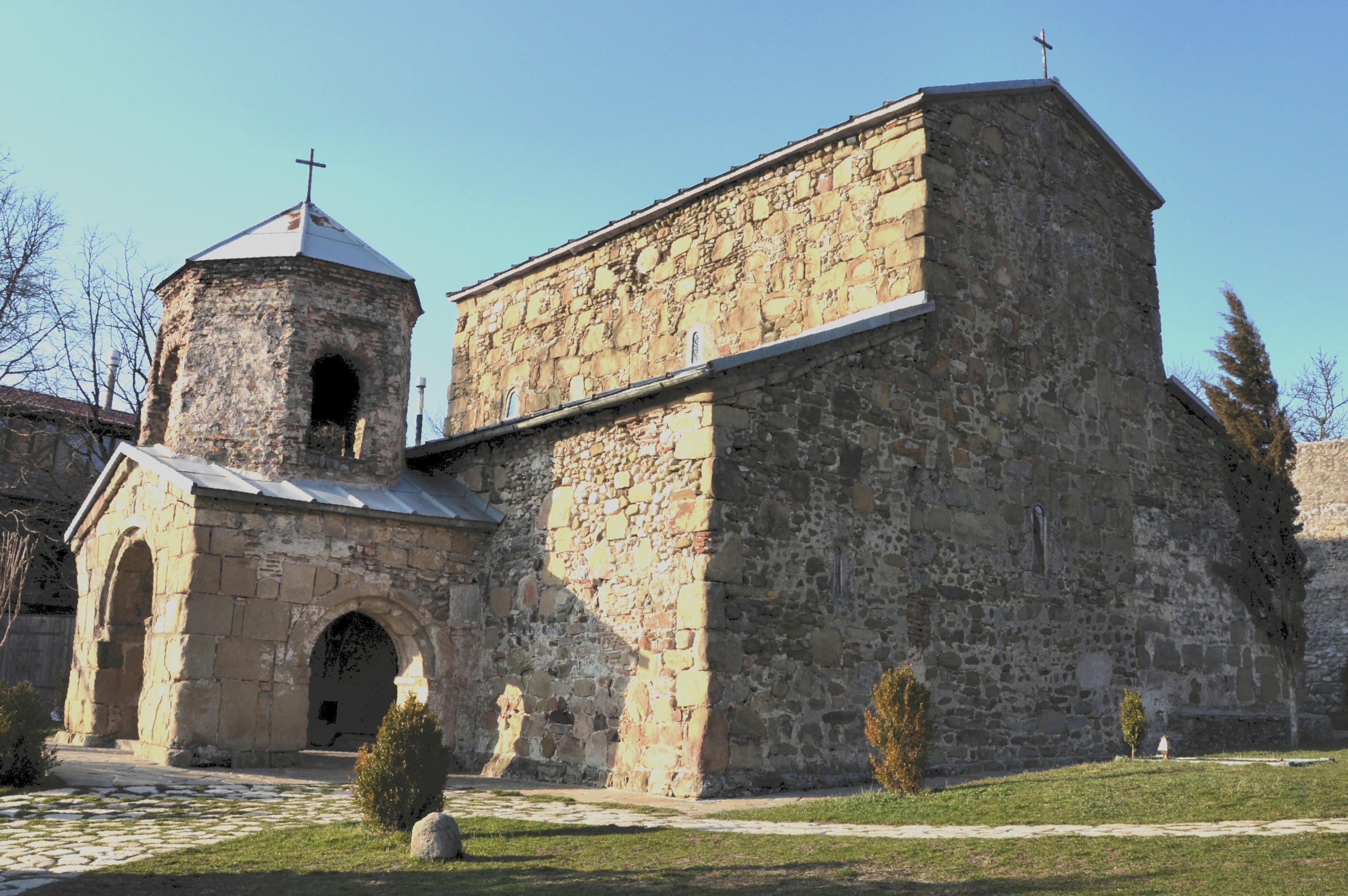
This is the big one. The full Gldani-Mamkoda-Zedazeni route covers roughly 22 km of demanding terrain through the wildest parts of Tbilisi National Park. The reward is experiencing the park's remote forests and finishing at a monastery that has stood watch over Georgia for 13 centuries.
Starting from Gldani on Tbilisi's northern outskirts, the trail gains elevation steadily as you head into the park. The Mamkoda section (6-6.5 km) passes St. George Monastery before the path steepens considerably. After Mamkoda, expect challenging terrain with beautiful mountain views.
Most hikers opt for the shorter version - driving to Mamkoda and hiking the remaining 15 km to Zedazeni. Even this truncated route requires 5-6 hours of solid hiking and strong fitness. The monastery itself, dating to the 7th-8th centuries, offers views of Jvari Monastery and the confluence of the Mtkvari and Aragvi rivers.
Distance: 15-22 km depending on starting point
Duration: 6-10 hours
Difficulty: Challenging
Best season: May to October
Getting there: Taxi to Mamkoda village (35-40 GEL), or start from Gldani (accessible by Tbilisi metro)
FAQ
What is the best hike near Tbilisi for beginners?
The Turtle Lake to Mtatsminda Park trail is ideal for beginners. The path is well-marked with clear signage, the terrain is manageable, and you can cut the hike short by taking the funicular down from Mtatsminda if needed. The Lisi Lake loop offers an even easier option with flat, paved paths.
Do I need hiking boots for trails near Tbilisi?
Most trails near Tbilisi can be done in sturdy trainers or trail running shoes. Proper hiking boots are recommended for Birtvisi Canyon, the Mamkoda to Zedazeni route, and any trail after recent rain when paths become muddy and slippery. Ankle support helps on rocky sections.
Are Tbilisi hiking trails marked?
Urban trails like Turtle Lake and Mtatsminda are well-marked with signage. More remote routes like Birtvisi Canyon have minimal markings - download a GPS track from Wikiloc or use Maps.me for offline navigation. Tbilisi National Park trails have trail markers and directional signs at major junctions.
Can I hike near Tbilisi in winter?
Yes, though trail conditions vary. Lower elevation trails like Kojori to Tbilisi and the Botanical Garden remain accessible year-round with possible snow patches. Higher routes like Saguramo Ridge and Mamkoda to Zedazeni may be snow-covered December through February. Samshvilde Canyon actually works well in winter due to its mild climate.
How do I get to trailheads without a car?
Several trails are accessible by public bus. Bus 380 goes to Kojori from Freedom Square. Bus 316 serves both Kojori and Kiketi. The funicular reaches Mtatsminda Park. For more remote trails like Birtvisi or Saguramo, book a transfer through GoTrip or use taxi apps like Bolt. Expect to pay 25-40 GEL for most taxi rides to trailheads.
Is it safe to hike alone near Tbilisi?
Urban trails within Tbilisi city limits are generally safe for solo hiking during daylight hours. For more remote routes, hiking with a partner is recommended. Carry a charged phone, download offline maps, and let someone know your planned route. Avoid trails after dark as most are unlit.
What wildlife might I encounter on Tbilisi hikes?
Tbilisi National Park is home to Caucasian red deer, lynx, wolves, and foxes, though large mammals are rarely spotted on day hikes. You are more likely to see tortoises, legless lizards (harmless, despite their snake-like appearance), and various birds. Georgia has venomous snakes active between May and September - stay aware on warmer months hikes.
When is the best time of year for hiking near Tbilisi?
Spring (April to June) and autumn (September to November) offer the best conditions. Spring brings wildflowers and pleasant temperatures. Autumn delivers colorful foliage, especially in Sabaduri Forest. July and August can be extremely hot at lower elevations. Winter hiking is possible but requires checking trail conditions.
How much water should I bring on day hikes?
Carry at least 2 liters per person for half-day hikes, more in summer heat. Samshvilde Canyon has no water sources on the trail. Tbilisi National Park has some springs along the Saguramo Ridge route. Never rely on finding water - always bring enough for the full distance.
Are there organized hiking groups in Tbilisi?
Yes, several companies and informal groups organize regular hikes near Tbilisi. Check social media groups for expat hiking meetups, or book guided day trips through local tour operators. Guided options are particularly worthwhile for Birtvisi Canyon and Mamkoda to Zedazeni, where local knowledge helps with navigation and safety.
Conclusion
Tbilisi punches well above its weight for accessible day hiking. You can climb to a medieval fortress before lunch, swim in a mountain lake by afternoon, and be back in the Old Town for dinner and wine. The trails span every difficulty level - from gentle lakeside strolls to all-day mountain treks - and most trailheads sit within an hour of the city. Pack your hiking shoes, download an offline map, and head for the hills.


